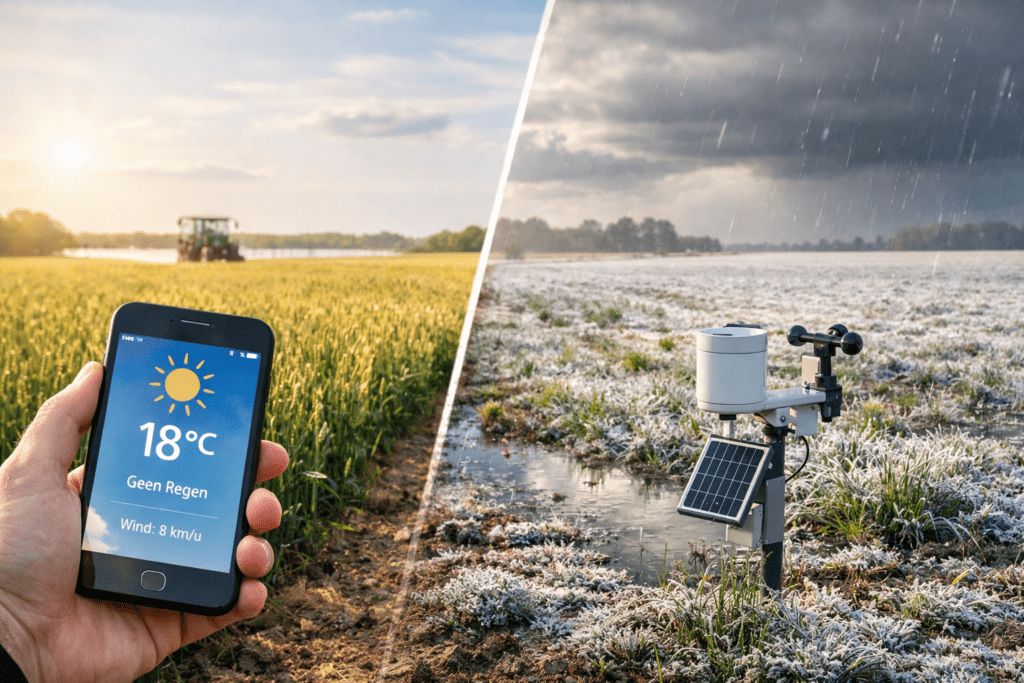
You check the agricultural weather forecast: 2 degrees, little wind, no rain. You make a plan. And yet, on your field there is ground frost in the hollow, the crop stays wet for longer, or a shower does fall after all. Then it feels as though the forecast got it wrong again.
But usually it is not wrong; it was made for a region. You have to decide for one spot. And it is exactly there, between regional and local, that the difference arises.
The weather forecast is regional, your growing decision is local
Weather models calculate on grids, and that makes sense; you cannot ‘compute’ every field separately. For many applications that works fine. But growing decisions are often determined by small differences: a corner of the field, a hollow, an open stretch where the wind has free rein.
Research into agricultural applications of seasonal forecasts shows that raw climate predictions first arrive at a coarser scale and are only then calibrated and downscaled to a finer grid. That makes them usable, but it remains an approximation, because a finer grid is still not an orchard corner or a frost pocket.
That is why there is another important step: post-processing. This means ‘repairing’ model output and making it usable, among other things by correcting bias and describing uncertainty better. In plain language: the weather forecast is not one truth; it is an expectation with a spread.
Three reasons why your field deviates
1) Altitude, shape and surroundings drive your microclimate
Even within a relatively small area, rainfall can be very unevenly distributed because of topography and local meteorology. That sounds ‘mountainous’, but the same mechanism also applies to smaller differences in height and landscape features: a ridge, a hollow, a forest edge, an open plain. This is exactly why it can be pouring on your land while the village down the road gets almost nothing.
Research into precipitation post-processing also shows that explicitly taking terrain height into account influences model output. What that really says is that terrain is not a backdrop; terrain drives what happens.
The practical consequence: the forecast can be right for ‘the region’ and still not fit your field, because your terrain and location work slightly differently.
2) Showers are local, and models remain uncertain
Forecasting rainfall remains difficult, even with modern models. Researchers name several causes: initial conditions (what you start from), numerical approximations, incomplete physics and the chaotic nature of the atmosphere. That is why post-processing is used to improve forecasts and quantify uncertainty.
The practical consequence: ‘2 mm’ is not a promise; it is an expectation. And your field may be just on the dry side, or on the wet side.
3) Your starting position determines the impact, not just what is coming
For agricultural choices, the starting situation often makes the difference. Research into forecasting agricultural drought shows that antecedent landscape conditions, in other words what was already in the system, strengthen the predictability of yield, pasture growth and even profit indicators.
The practical consequence: the same weather forecast can mean ‘no problem’ for grower A and ‘stress building up’ for grower B, because the soil reserve and crop condition are different. The forecast tells you what is coming, but not how your field is doing.
Where this costs you money: three familiar situations
Situation 1: frost or ground frost in the hollow
The forecast says just above zero. Your hollow touches zero or lower. You only notice when it is already turning white. Then you are not late because you did not look, but because the regional forecast does not take your hollow into account.
Situation 2: wet hours without ‘rain’
The app says: no rain. Yet the crop stays wet for a long time because of dew and high humidity. You base your planning on a ‘dry day’, but the real risk lies in the hours that the leaves stay wet. You only notice this when you think afterwards: I should have planned differently.
Situation 3: drought building up that you do not see coming
The forecast suggests some rain is on the way and it will not be too bad. But your field already started with little reserve. Then a ‘small setback’ can suddenly have an impact after all. This ties in with the point from research: the starting situation strongly determines how predictable the impact is.
From weather forecast to field decision: a simple approach that reduces doubt
You do not have to throw the weather forecast away. You just have to use it differently: as a direction, which you then make robust locally.
Step 1: choose three moments when timing really counts
Choose three, not ten. For example: spray windows around rainfall, water availability, risk moments such as cold nights or longer wet periods.
Step 2: make one local check per moment
For rainfall: what actually falls on my land, not just what falls ‘somewhere in the region’.
For water: what is my starting position, how is my soil reserve, because that determines the impact.
For terrain: where is my weak spot, hollows, open stretches, edges, because topography and local differences demonstrably play a role.
Step 3: turn that check into one action
No extra dashboards, no extra interpretation. One rule per risk. If this happens, I do this; if it does not happen, I do nothing.
Examples you can use straight away
If the forecast reaches threshold values and my field is sensitive, I check locally and plan my action in advance.
If rainfall is uncertain, I plan my work around the probability, not around a single number.
If my starting position is already tight, I do not wait for visible stress; I adjust earlier.
To conclude
The weather forecast does not have to be perfect. Above all, your decision needs to be robust, even if the shower shifts slightly, even if your field responds differently from the average. Research shows why: models work with grids, uncertainty is part of it, terrain influences outcomes and the starting situation determines impact.
If you add two things, local context and one threshold with one action, it becomes less guessing and more managing.
Sources
Schepen, A., Bolt, A., Bruget, D., et al. (2025). Forecasting agricultural drought, the Australian Agricultural Drought Indicators. Natural Hazards and Earth System Sciences, 25, 4053–4070. https://nhess.copernicus.org/articles/25/4053/2025/
Esquivel-González, M., González, A., Pérez, J. C., Díaz, J. P. (2025). Postprocessing of convection permitting precipitation forecast using UNets. Ecological Informatics, 90, 103255. http://colab.ws/articles/10.1016%2Fj.ecoinf.2025.103255